SpatiEdge supported Odisha’s Borewell & Irrigation Expansion Programme through geo-referenced mapping of borewells, pump sets, and irrigation infrastructure. The project delivered accurate spatial intelligence for groundwater assessment, irrigation planning, site suitability analysis, and optimized agricultural water resource allocation.

Menu

Borewell & Irrigation Expansion Programme – Agriculture Dept. & APICOL
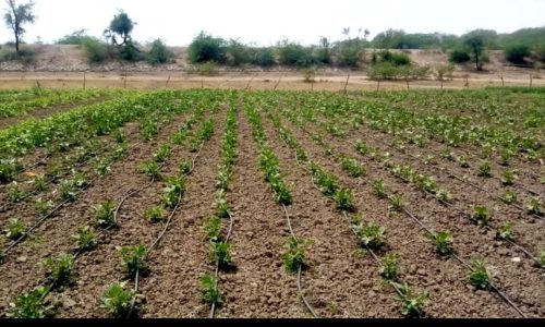
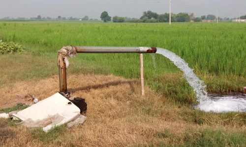
Project Overview
The Borewell & Irrigation Expansion Programme was implemented by SpatiEdge Technologies Pvt. Ltd. to support the Government of Odisha’s irrigation initiatives. The project focused on creating an accurate spatial inventory of borewells and irrigation infrastructure, enabling efficient groundwater management, planning of new irrigation facilities, and enhanced agricultural resource allocation.
Client / Stakeholders
Department of Agriculture, Government of Odisha
APICOL Odisha ( Agricultural Promotion and Investment Corporation of Odisha Limited (APICOL) )
Project Objectives
Map existing borewells and irrigation infrastructure
Support planning and expansion of irrigation facilities
Enable effective groundwater resource management
Provide GIS-based decision support for agricultural planning
Scope of Work
DGPS-based borewell location surveys
Mapping of irrigation command areas and infrastructure
Creation of GIS-based borewell and irrigation asset databases
Spatial analysis to identify irrigation gaps and potential expansion zones
Integration with departmental planning systems
Methodology & Technical Approach
SpatiEdge conducted high-precision DGPS surveys to capture accurate locations of borewells and irrigation assets. Survey data was integrated into GIS platforms, providing thematic layers for command areas, irrigation networks, and asset inventories. Analytical workflows were applied to identify gaps and optimize planning for irrigation expansion.
Technologies & Tools
DGPS / GNSS Survey Systems
GIS Platforms (ArcGIS / QGIS)
Satellite Imagery for validation
CAD–GIS Integration
Key Deliverables
GIS maps of borewell locations and irrigation infrastructure
Command area GIS layers and spatial databases
Reports on irrigation gaps and planning recommendations
Department-ready GIS datasets for planning and monitoring
Impact & Outcomes
Improved accuracy in irrigation planning and groundwater management
Enhanced allocation of agricultural resources
Supported farmer-centric irrigation expansion initiatives
Strengthened evidence-based decision-making for the Agriculture Department
This project illustrates SpatiEdge Technologies’ capability to deliver precise, data-driven geospatial solutions for efficient agricultural planning and resource management.