

Tribal GIS Micro Project – CBDA (SCSTRTI)
GIS-based technical support for planning and monitoring development initiatives in tribal and scheduled areas, enabling data-driven decision-making aligned with government guidelines.
Project Overview
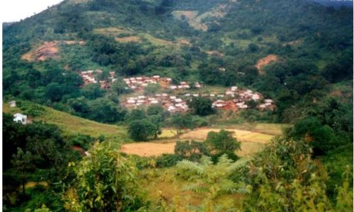
The Tribal GIS Micro Project was executed by SpatiEdge Technologies Pvt. Ltd. to develop localized GIS datasets supporting tribal development planning and welfare initiatives in Odisha. The project aimed to provide accurate, spatially referenced data at the village and block level to facilitate targeted interventions and policy implementation for tribal communities.
Client / Stakeholders
CBDA (Centre for Biodiversity and Development Action) – SCSTRTI
Government of Odisha – Tribal Welfare and Planning Departments
Project Objectives
Create micro-level GIS datasets for tribal villages and settlements
Map infrastructure, natural resources, and socio-economic indicators
Support data-driven planning and implementation of welfare programs
Enable monitoring and evaluation of tribal development initiatives
Scope of Work
Collection of village-level spatial data through field surveys
Mapping of infrastructure, land use, and natural resources
Integration of socio-economic indicators with GIS layers
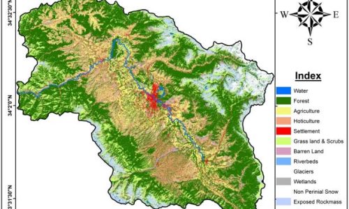
Preparation of thematic maps and spatial databases for planning purposes
Validation and quality assurance of datasets with ground-truthing
Methodology & Technical Approach
SpatiEdge adopted a community-focused GIS methodology combining field surveys, remote sensing, and existing administrative data. DGPS surveys and GPS-enabled mapping were used to capture village boundaries and key infrastructure. GIS layers were structured to integrate both physical and socio-economic datasets, ensuring that planners could make informed, evidence-based decisions for tribal welfare.
Technologies & Tools
DGPS / GNSS Survey Systems
GIS Platforms (ArcGIS / QGIS)
GPS-enabled field mapping tools
Satellite imagery for land use validation
Key Deliverables
Village-level GIS maps for tribal areas
Thematic layers on infrastructure, natural resources, and socio-economic indicators
GIS-ready spatial databases for planning and monitoring
Technical reports and documentation
Impact & Outcomes
Improved targeting and implementation of tribal welfare programs
Enhanced spatial understanding of tribal settlements and resources
Supported data-driven decision-making at the micro-level
Strengthened institutional capacity for monitoring and planning tribal development